How to Create a Travel Itinerary on a Map and Share It Online with Anyone
Travel planning often starts with excitement but quickly becomes overwhelming. Between scattered notes, saved locations on different apps, and group chats filled with suggestions, it’s easy to lose track of the actual plan. For group travel, sharing clear, visual itineraries becomes even more essential. This is where geographic information systems (GIS) come in—not just for professionals, but now increasingly for travelers and creators.
GIS tools allow anyone to convert ideas, places, and routes into visual stories layered on maps. They make the journey clearer, the planning smoother, and the sharing seamless. Whether you're a solo backpacker or organizing a corporate retreat, using a map-based itinerary streamlines the experience for all involved.
How GIS Enhances Travel Itinerary Planning
GIS isn't just for land surveying and urban planning anymore. It’s revolutionizing how people approach everyday challenges like trip planning. By mapping out stops, day-wise plans, locations, and routes visually, you're not only organizing better but also making it easier for others to follow and contribute.
Industries like tourism, hospitality, events, and even local governments are adopting interactive maps to showcase trails, promote local tourism, or help citizens access public event routes. From tour operators to bloggers and adventure groups, mapping software is becoming the central piece in itinerary creation.
Visualizing Your Journey Day-by-Day
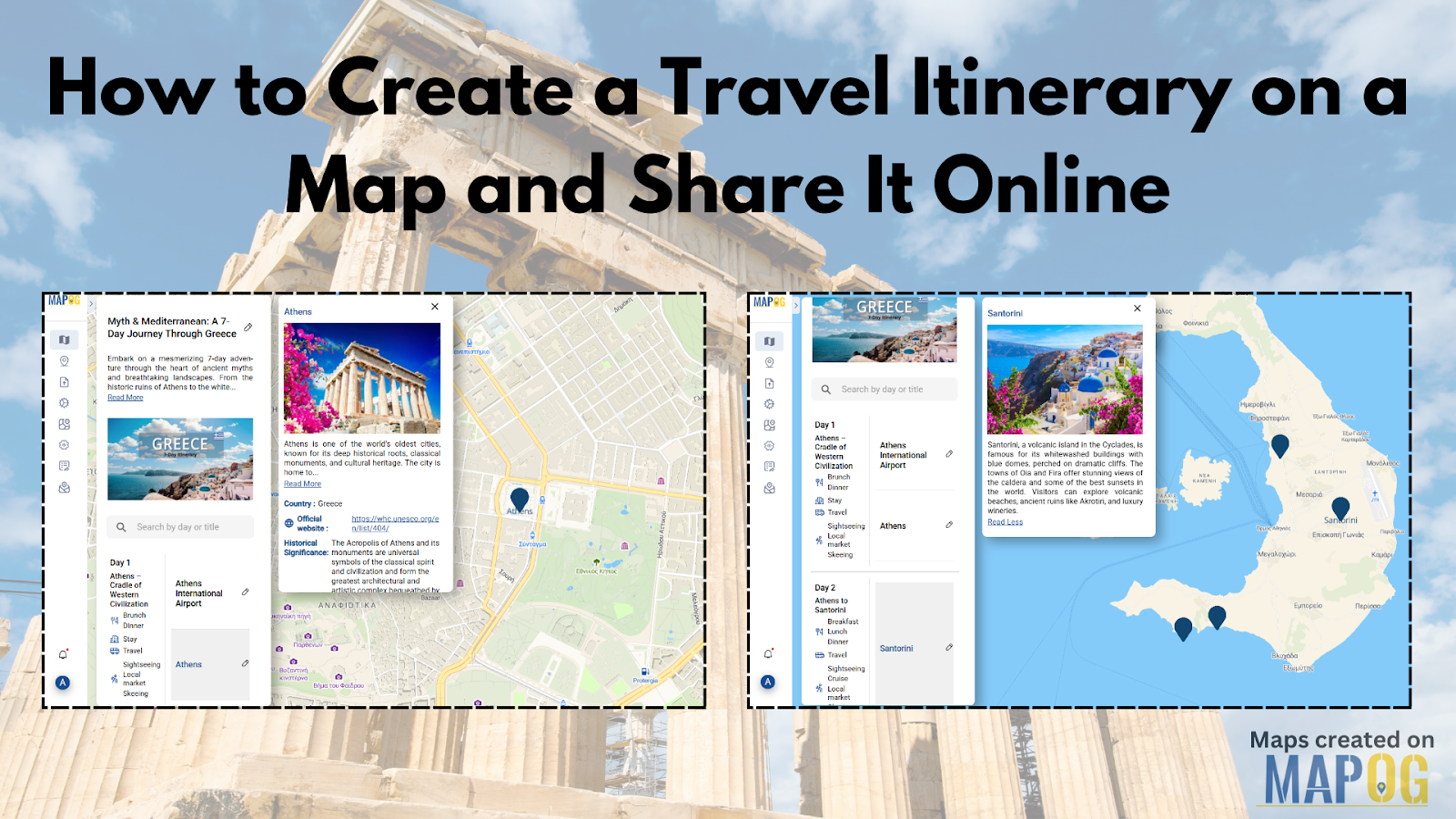
Imagine you're planning a 7-day itinerary for Greece. Instead of using static spreadsheets, you could map each day's highlights—from Athens' ancient ruins to Santorini’s sunsets. On a GIS-powered storytelling platform, you’d simply add each stop by searching addresses or dropping coordinates, input descriptions, upload images, and layer them by day. It’s not just about navigation—it’s about crafting a narrative your fellow travelers can see and feel.
You can even preview the entire route and share a public link—perfect for friends, clients, or blog readers. This transforms your itinerary from a checklist into an immersive experience.

One Platform That Lets You Do It All
Some modern platforms now combine GIS with storytelling, allowing you to build, layer, and share travel plans in a few clicks. One such option is MAPOG. With its intuitive interface, you can create something like “7 Days in Greece,” manually add spots using coordinates or addresses, include detailed descriptions, and visually organize your plan day by day.
You don’t need to be a cartographer—just someone with a story to tell or a trip to plan. Once done, simply hit preview and share your interactive map with anyone, anywhere.
Final Thoughts
In a world of spontaneous detours and tightly-packed schedules, having a travel itinerary mapped out makes all the difference. And when you can layer it with visuals, routes, and information in one accessible view, it becomes more than a plan—it becomes a travel story.
If you're planning your next trip, explore how maps can enhance your workflow. Try a platform that lets you build and share your travel map story effortlessly—you might find yourself not just planning but storytelling.


