Best Alternatives to Google My Maps for Sharing Travel Stories
Creating and sharing travel stories visually has become an essential part of how we relive and communicate our journeys. Yet, for many users, tools like Google My Maps come with limitations—especially when maps get crowded, collaborative editing becomes tricky, or deeper storytelling needs arise. Travelers, tour operators, bloggers, and researchers often look for alternatives that give them more creative control, flexibility, and mapping accuracy. That’s where advanced geographic tools, rooted in GIS (Geographic Information Systems), step in to offer smarter solutions.
The GIS Angle: Why It's More Than Just Pinning Places
Modern travel mapping has evolved far beyond plotting pins and drawing paths. GIS brings in spatial intelligence—it helps map not just where, but why, when, and how something happens. Instead of only displaying places you visited, GIS-backed platforms allow travelers to tell layered stories: where you stayed, how long, what you experienced, and even trends in the places you explore. For travel businesses and local tourism boards, this isn’t just storytelling—it’s actionable insight. They can visualize movement patterns, identify hotspots, and better understand travel behavior.
Sectors like tourism, heritage conservation, event planning, and even educational institutions now rely on such mapping tools to build engaging travel timelines. Think of curated student excursions, digital guidebooks, or even group itineraries where roles like editors and contributors can be assigned. These aren’t just maps—they’re interactive travel narratives powered by data.
What Makes a Great Travel Story Map?
To make an engaging digital travel story, flexibility matters. The ability to manually search and pin exact addresses, write descriptive notes, upload photos, and categorize places into daily timelines creates a richer experience. Visual storytelling with maps means structuring each day’s activity with clarity—so future viewers (or even your travel partners) can understand not just what was visited, but how the journey unfolded.
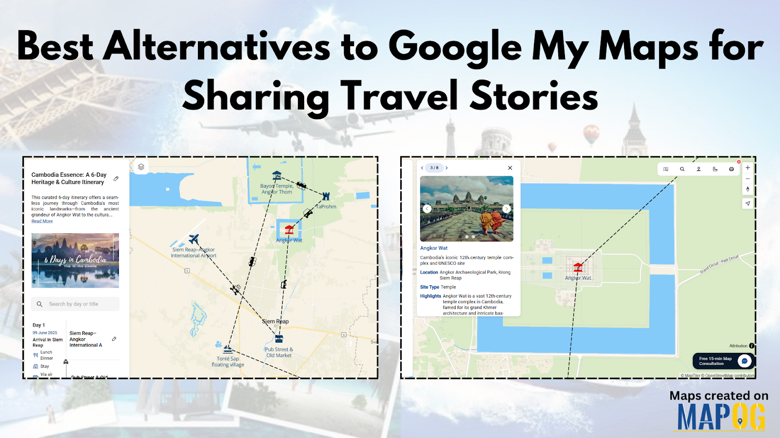
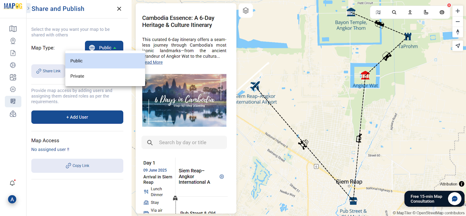
Let’s take a sample story—say, a 6-day Cambodia itinerary. You might want to mark key stops like Siem Reap, Angkor Wat, Tonlé Sap, or Phnom Penh. Instead of just flagging points, some platforms allow you to add day-by-day notes, use custom attributes like “Meal Spot,” “Cultural Visit,” or “Relaxation Time,” and embed it all directly into your blog. Readers get to follow the trail visually and contextually. And if you're working in a group, you can even allow others to view, edit, or comment on the story map without having to export dozens of files back and forth.
A Platform That Quietly Checks All the Boxes
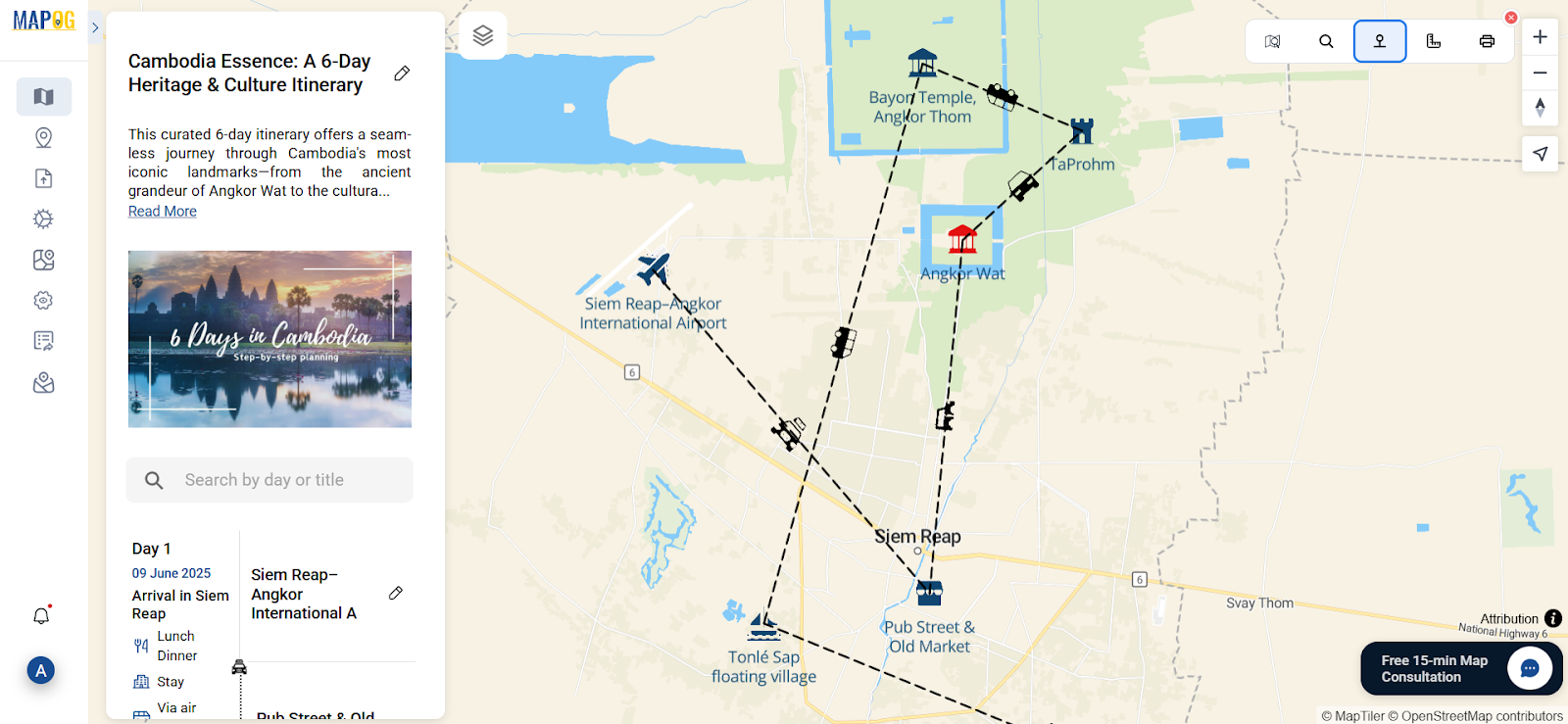
For those seeking something more adaptable than Google My Maps, there are platforms designed with storytelling in mind, while keeping the interface beginner-friendly. One such option allows users to create grid-based or point-based maps, embed them in blogs or presentations, assign user roles, and apply both personal travel insights and technical GIS layers—all from a browser-based interface. You can explore one such tool such as MAPOG. It’s worth checking out if you’re looking to mix intuitive design with deeper mapping features.
Final Thoughts
Digital travel storytelling is not just about marking destinations—it’s about translating a journey into a shareable, interactive experience. And as the landscape of mapping tools continues to grow, there’s room for better, smarter alternatives that adapt to the needs of explorers, planners, educators, and creators alike. Whether you're a solo traveler, a guide curating cultural walks, or a travel blogger planning your next post, consider platforms that go beyond the basics. You might just find your next journey worth mapping—differently.