GIS Mapping of Landslide-Prone Villages and Road Access Analysis
In many parts of the world, landslides pose serious threats to rural villages, especially those tucked away in hilly terrains with limited road infrastructure. The challenge lies not only in identifying the high-risk zones but also in ensuring that emergency services can reach these areas quickly. This is where GIS comes into play, offering a data-driven approach to analyze vulnerabilities and plan better access routes. Today, communities, disaster management teams, and local planners are embracing GIS as a proactive tool to reduce risks and improve decision-making.
Understanding the Role of GIS in Landslide Risk Planning
GIS allows users to layer diverse datasets—from elevation and slope to rainfall patterns and road conditions—onto a single interactive map. By doing so, it becomes easier to visualize where potential risks lie and which communities may be affected. When it comes to mapping landslide-prone areas, GIS is especially valuable for conducting terrain analysis and simulating how a landslide event could impact infrastructure.
Industries Benefiting from This GIS-Based Approach
Disaster response agencies are among the most active users of GIS in this space. With data integration, they can quickly assess where to send aid and how best to reach vulnerable areas. Urban and rural development planners also use GIS to identify safe zones for future construction or to reroute existing roads to avoid unstable terrain.
Additionally, NGOs working in community safety, climate resilience, and infrastructure development depend on these insights to support at-risk populations. Even telecom and utility companies are increasingly using GIS mapping to ensure their infrastructure avoids landslide-prone corridors, reducing service disruption during natural disasters.
Solving Real Problems with Spatial Analysis
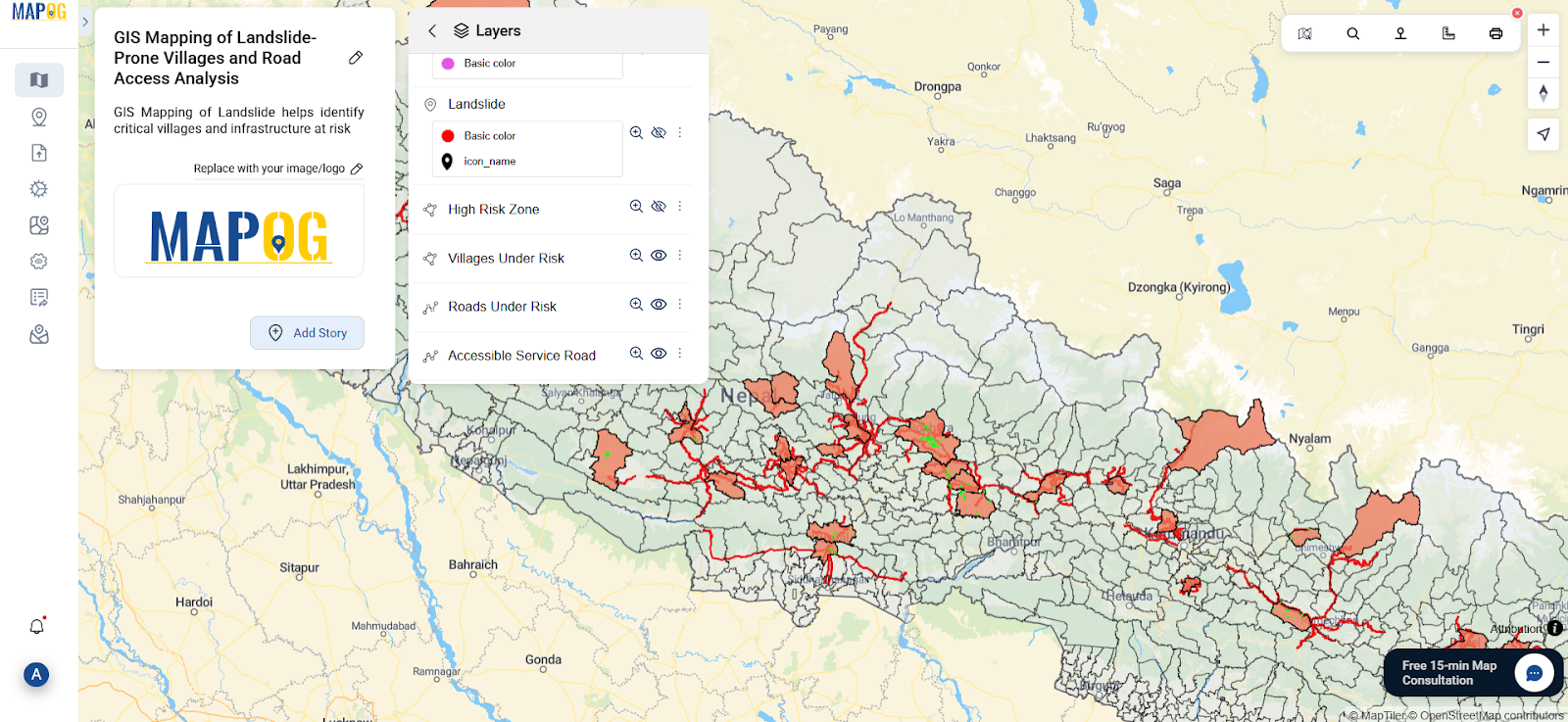
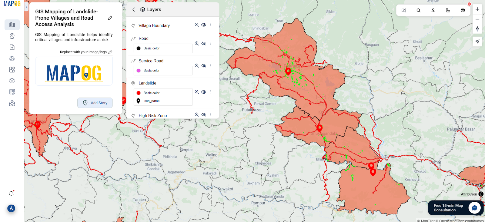
The true power of GIS lies in its ability to turn complex geospatial data into understandable and actionable insights. For example, in a recent project, landslide points were uploaded and buffered within a 5 km radius. By intersecting these buffers with road and village layers, high-risk areas were flagged, and alternative service road access routes were identified. This not only helped in mapping vulnerable regions but also in planning safer, faster access for emergency teams.
Shareable, Accessible, and Interactive Mapping


