How GIS Helps in Identifying High-Growth Areas for Real Estate Investment
In the ever-shifting world of real estate, identifying the right investment location can feel like chasing shadows. Often, developers and investors rely on intuition or fragmented reports, which leads to misjudged investments or missed opportunities. But with increasing access to Geographic Information Systems (GIS), there’s a smarter way forward. GIS doesn't just visualize spaces—it reveals why those spaces matter and how they’re likely to evolve.
By integrating location-based data with demographics, infrastructure, amenities, and urban development patterns, GIS helps map out growth trajectories long before they become visible on the ground. Real estate stakeholders, urban planners, and infrastructure consultants are using GIS to gain a head start—and it's changing how decisions are made.
The Role of GIS in Real Estate Strategy
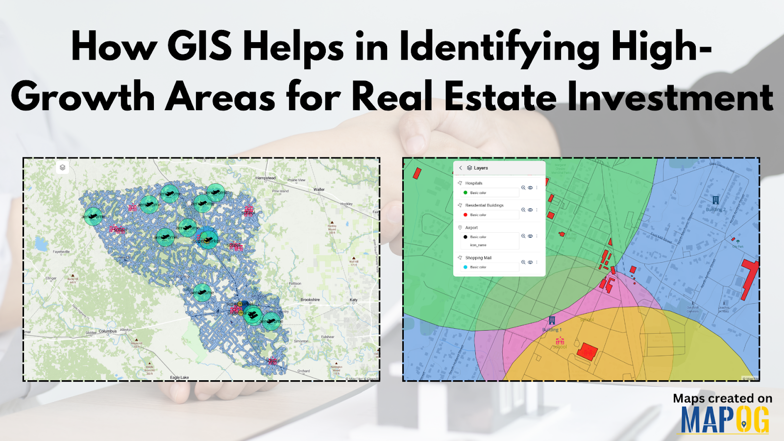
GIS technology allows users to view and analyze data spatially, offering an edge when it comes to evaluating location potential. For instance, one can assess proximity to critical infrastructure like roads, public transit, airports, hospitals, schools, shopping malls, and even entertainment zones. When all of this information is layered onto a single interactive map, potential investment zones begin to emerge with clarity.
One of the key benefits of using GIS is how it highlights connectivity. A property might look promising on paper but may not offer seamless access to commercial or social infrastructure. With GIS, such gaps are immediately visible, helping investors avoid costly mistakes.
Furthermore, tools that utilize GIS let you build buffer zones—essentially drawing radius areas around key facilities like metro stations or highways. This technique is incredibly useful for defining walkable neighborhoods or high-demand rental pockets. Some platforms even allow users to add proposed development projects to the map for forward-looking insight—especially useful for city planners and real estate analysts who want to stay ahead of the curve.
Who’s Using GIS to Drive Real Estate Growth?
Industries such as urban planning, commercial development, and public infrastructure are seeing significant value in GIS-backed planning. Smart city projects, in particular, rely on such spatial analysis to determine where to invest in roads, water supply, or housing clusters. Financial institutions and private equity firms are also using it to evaluate land value appreciation over time, ensuring their money flows to high-growth corridors.
In emerging economies, GIS is empowering sustainable housing projects by locating underdeveloped yet accessible land zones, ensuring affordability and growth potential go hand in hand. Retail chains and logistics firms, too, benefit by optimizing where they set up their next outlet or distribution center using the same data principles.
From Data to Decision: Mapping Tools in Action
Some mapping platforms offer an intuitive interface where users can access data libraries, plot layers like hospitals and schools, define buffer zones, and even annotate proposed buildings—all visually. These maps can be previewed and shared with teams or stakeholders for collaborative decision-making.
If you're looking to try such a tool, explore platforms that support GIS-based visual storytelling—some of them are quite beginner-friendly. One such example is MAPOG, which allows you to combine real estate planning with interactive visualization. It’s worth trying if you want to blend data analysis with clear visual narratives.

Final Thoughts
Real estate isn’t just about location anymore—it’s about insight. GIS has turned mapping into a strategic tool, giving investors a way to identify high-growth areas before they become obvious. Whether you're evaluating a single site or planning a city-scale development, spatial intelligence makes your choices smarter and more future-proof.


